GWES
Integrated management and optimization system for logistics facilities
GWES - Integrated management and optimization system for logistics facilities
Digitalization of Facility Maps by GWES
Overview
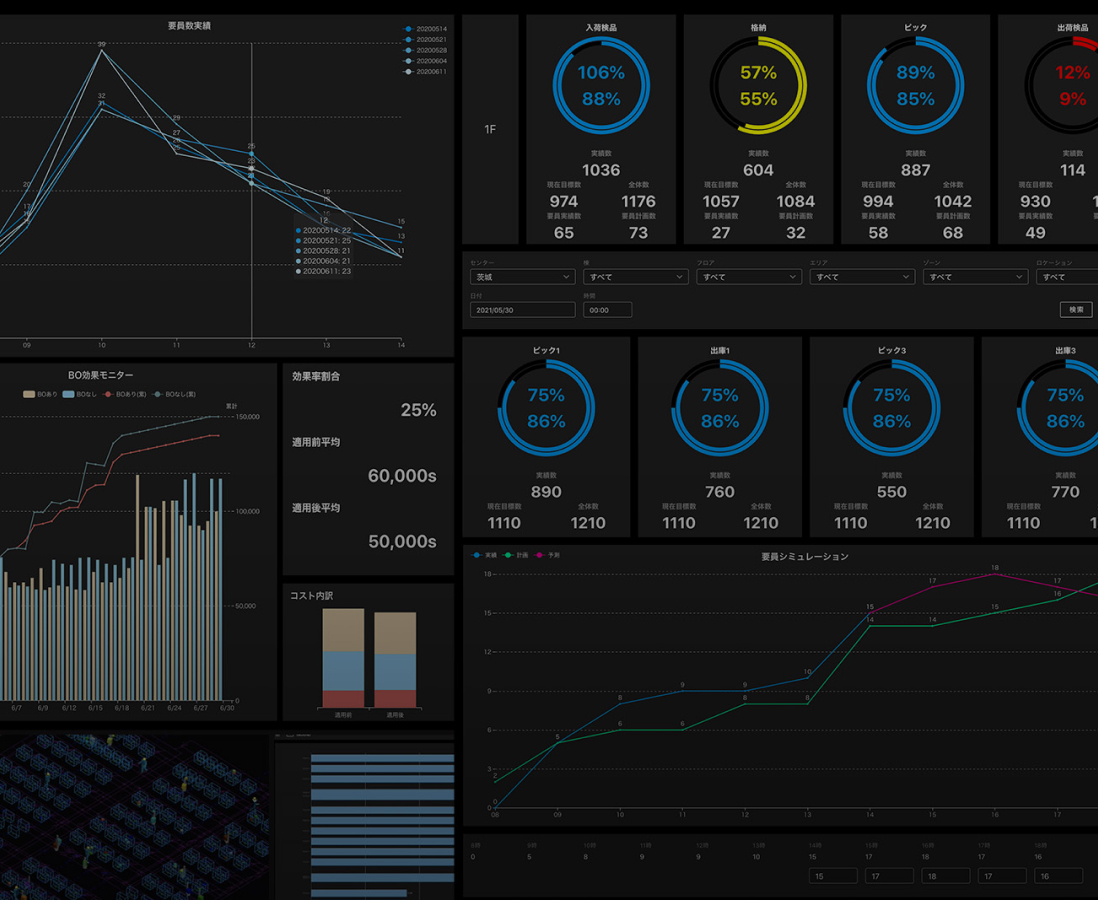
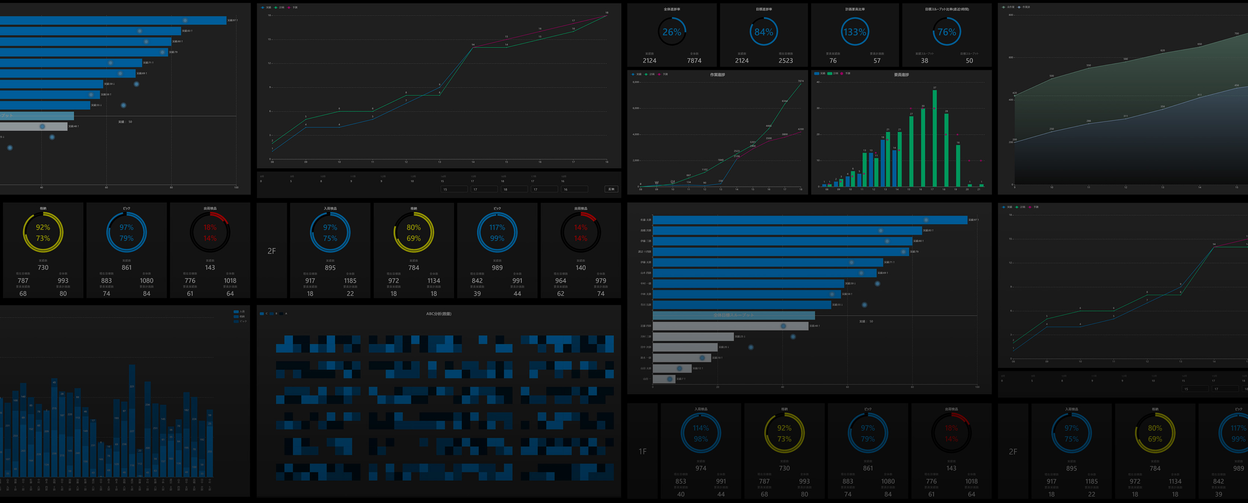
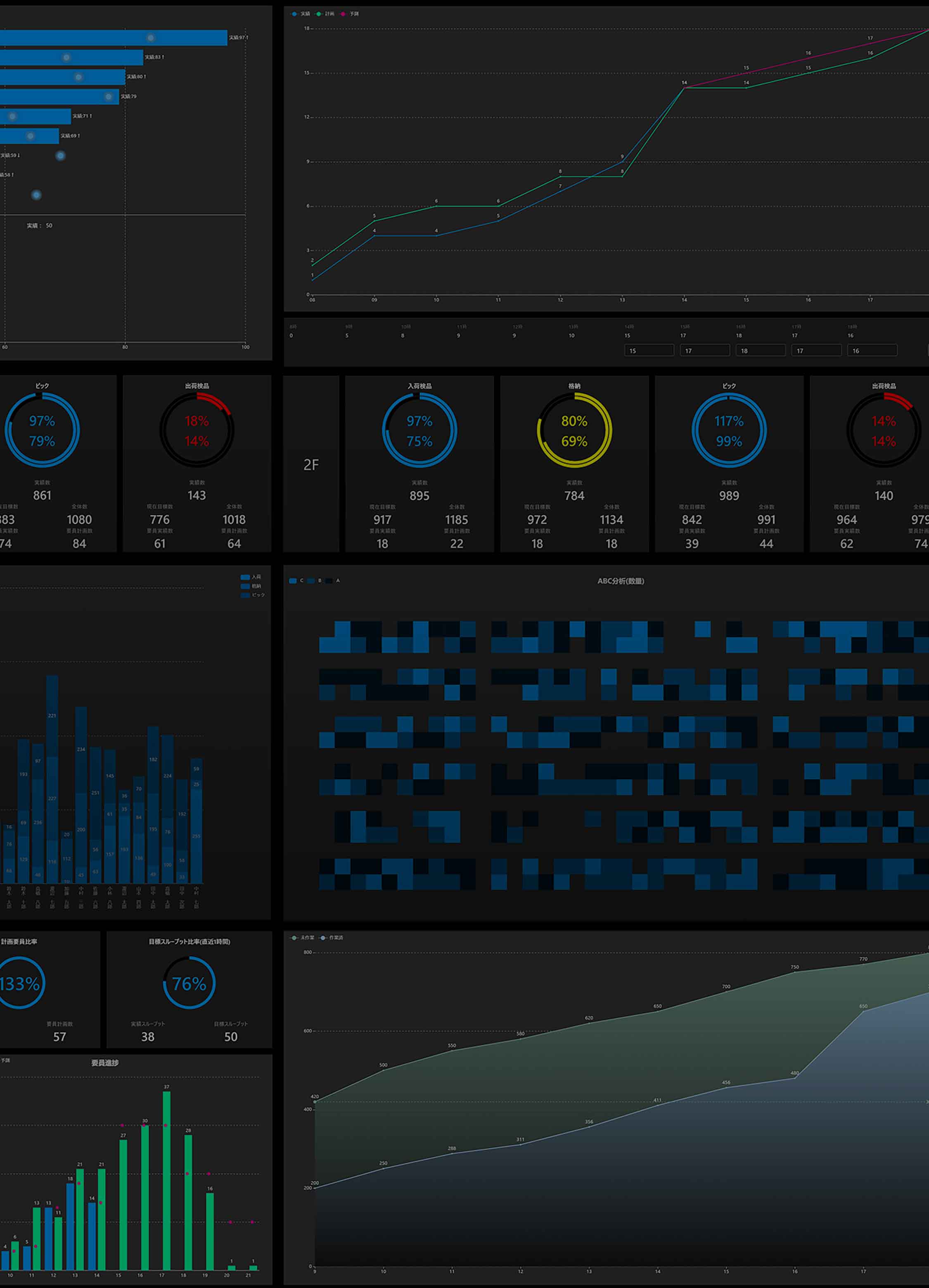
GWES, the integrated management and optimization system for logistics facilities, has a module that enables the easy digitalization of logistics facility maps.

Map Editor
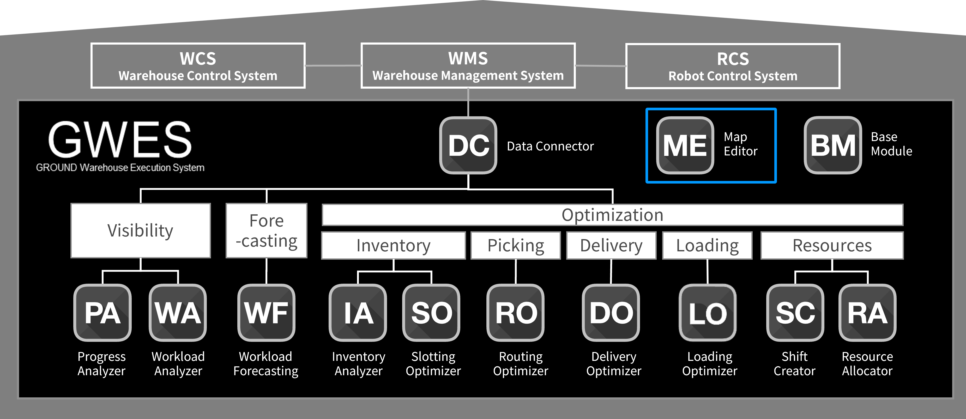
Features
Easy digitalization of logistics facility maps
Map Editor enables an easy digitalization of logistics facility maps and updates in floor design or operational rules.
Supporting improvements in the efficiency of logistics operations and the overall optimization of logistics facilities
MAP Editor lets users generate digital maps considering the facilities’ unique operational rules and constraints, therefore, the optimization scenario of the operations are always realistic.